
Your Idea-We handle the How.
Any size, any cadence—daily layer & attribute updates or one-off maps. Short term or long term—we’ve got you covered.
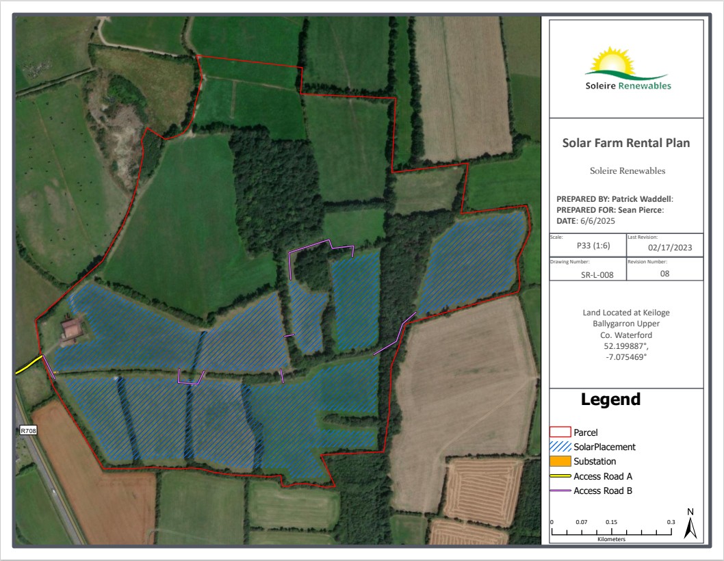
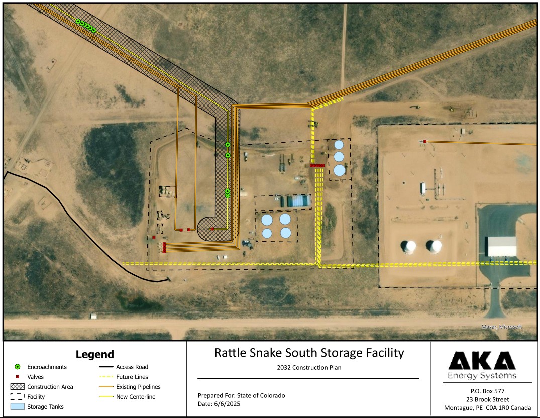
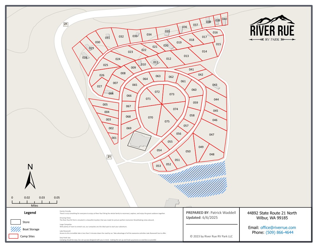
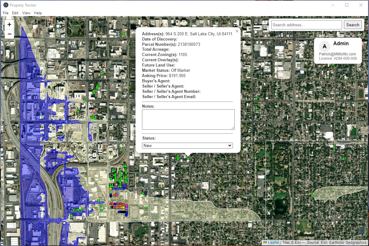
We build a product that people actually use—trail maps, storm-surge tools, parcel/permit portals, open-data hubs, custom one-off maps. This page isn’t a museum; it’s a short menu of ideas that we have delivered. Give us your outcome and data mess, and we’ll turn it into clear, actionable results.
What you get with every Misfit build
- Clarity: plain-English labels, clean legends, and symbology that actually reads.
- Accuracy: layer & attribute QA, projection sanity, schema you can live with.
- Speed: quick first look, then tighten with your feedback (no endless cycles).
- Ownership: you keep the data, the files, and the admin keys—no hostage situations.
- Accessibility: mobile-friendly web maps and print-clean PDFs.
- Docs that help: short “how to use it” notes, not a 40-page manual.
- Future-proofing: easy to update, easy to hand off, easy to scale.
Work modes:
- One-off build — need it once, done.
- Scheduled updates — daily/weekly/monthly layer & attribute refresh.
- On-call help — small fixes, tweaks, and emergencies.
- Cleanup only — we tidy your data so your team can roll.
- Budget-friendly - we can work within your budget constraints; no surprises.
Data we can take as-is
Shapefiles, GeoPackage, File/Enterprise Geodatabase, CSV/Excel with addresses, KML/GPX, ArcGIS Online/Feature Services, PostGIS/SQL exports—yes, even a single GPS coordinate—or the dreaded “folder of mixed stuff.”